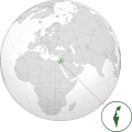
Seswantšho:ISR orthographic.svg

Size of this PNG preview of this SVG file: 600 × 600 pixels. Other resolutions: 240 × 240 pixels | 480 × 480 pixels | 768 × 768 pixels | 1,024 × 1,024 pixels | 2,048 × 2,048 pixels.
''resolution'' ya gofella (SVG faele, nominally 600 × 600 pixels, bogolo ba faele: 1.39 MB)
Histori ya faele
Pinyeletša go letšatšikgwedi/nako go bona faela ka tsela yeo ebego e le ka gona nakong yeo.
| LetšatšiKgwedi/Nako | Nkgogorupo-Nala | Bogolo | Mošomiši | Comment | |
|---|---|---|---|---|---|
| bjale | 05:46, 17 Hlakola 2022 |  | 600 × 600 (1.39 MB) | Chaddy | Reverted to version as of 06:27, 24 March 2019 (UTC), there is already another map for the disputed borders: File:Israel (orthographic projection) with disputed territories.svg |
| 11:48, 10 Hlakola 2022 |  | 600 × 600 (1.4 MB) | Beshogur | Reverted to version as of 06:25, 24 March 2019 (UTC) | |
| 08:27, 24 Hlakola 2019 |  | 600 × 600 (1.39 MB) | BlueHypercane761 | Reverted to version as of 22:09, 21 September 2016 (UTC) Self-revert. As legitimate as this revision is, I will split it off into a new image file. | |
| 08:25, 24 Hlakola 2019 |  | 600 × 600 (1.4 MB) | BlueHypercane761 | Restoring previous revision temporarily to retrieve image. | |
| 00:09, 22 Lewedi 2016 |  | 600 × 600 (1.39 MB) | Nableezy | make a new map, this one is fine | |
| 20:50, 16 Lewedi 2016 |  | 600 × 600 (1.4 MB) | Bolter21 | added disputed territories | |
| 05:06, 8 Mosegamanye 2012 |  | 600 × 600 (1.39 MB) | Addicted04 | America land | |
| 04:42, 8 Mosegamanye 2012 |  | 600 × 600 (1.39 MB) | Addicted04 |
Tirišo ya Faele
Letlakala le ke latelago a hlomaganya go faele ye:
Global file usage
The following other wikis use this file:
- Usage on af.wikipedia.org
- Usage on am.wikipedia.org
- Usage on arc.wikipedia.org
- Usage on av.wikipedia.org
- Usage on ay.wikipedia.org
- Usage on azb.wikipedia.org
- Usage on az.wiktionary.org
- Usage on ban.wikipedia.org
- Usage on bbc.wikipedia.org
- Usage on bcl.wikipedia.org
- Usage on bg.wikipedia.org
- Usage on bh.wikipedia.org
- Usage on bi.wikipedia.org
- Usage on bn.wikipedia.org
- Usage on bs.wikipedia.org
- Usage on bxr.wikipedia.org
- Usage on cdo.wikipedia.org
- Usage on ceb.wikipedia.org
- Usage on chr.wikipedia.org
- Usage on ckb.wikipedia.org
- Usage on cs.wikipedia.org
- Usage on da.wikipedia.org
- Usage on dty.wikipedia.org
- Usage on el.wikipedia.org
- Usage on en.wikipedia.org
- Usage on en.wikibooks.org
- Usage on es.wikipedia.org
- Usage on eu.wikipedia.org
- Usage on fi.wikipedia.org
- Usage on fr.wikipedia.org
- Usage on gn.wikipedia.org
- Usage on gu.wikipedia.org
- Usage on gv.wikipedia.org
- Usage on hak.wikipedia.org
- Usage on hr.wikipedia.org
- Usage on hy.wikipedia.org
- Usage on id.wikipedia.org
- Usage on ie.wikipedia.org
- Usage on incubator.wikimedia.org
View more global usage of this file.