Seswantšho:LocationAmericas.png

Size of this preview: 800 × 407 pixels. Other resolutions: 320 × 163 pixels | 640 × 326 pixels | 1,024 × 521 pixels | 1,280 × 651 pixels | 2,759 × 1,404 pixels.
''resolution'' ya gofella (2,759 × 1,404 pixel, bogolo ba faele: 99 KB, Mohuta wa MIME: image/png)

|
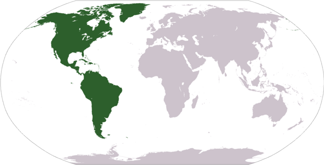
File:Location of America.svg is a vector version of this file. It should be used in place of this PNG file when not inferior.
File:LocationAmericas.png → File:Location of America.svg
For more information, see Help:SVG. |
 |
Kakaretšo
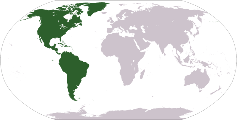
Deutsch: Weltkarte mit Fokus auf Amerika
English: World map depicting America
Esperanto: Mondmapo bildiganta Amerikon
Español: Ubicación de América
map adapted from PDF world map at CIA World Fact Book
Laesense
This image is in the public domain because it contains materials that originally came from the United States Central Intelligence Agency's World Factbook.
|
 |
Histori ya faele
Pinyeletša go letšatšikgwedi/nako go bona faela ka tsela yeo ebego e le ka gona nakong yeo.
| LetšatšiKgwedi/Nako | Nkgogorupo-Nala | Bogolo | Mošomiši | Comment | |
|---|---|---|---|---|---|
| bjale | 14:31, 19 Pherekgong 2008 | | 2,759 × 1,404 (99 KB) | F l a n k e r | Transparency |
| 21:11, 12 Diphalane 2005 |  | 2,759 × 1,404 (55 KB) | E Pluribus Anthony~commonswiki | World map: Americas (location) | |
| 17:06, 29 Moranang 2005 |  | 1,377 × 699 (16 KB) | Ghalas | Extracted from CIA World Factbook PDF world map, then rasterized and colored. {{PD-USGov-CIA-WF}} |
Tirišo ya Faele
Letlakala le ke latelago a hlomaganya go faele ye:
Global file usage
The following other wikis use this file:
- Usage on als.wikipedia.org
- Usage on ar.wikipedia.org
- البحر الأبيض المتوسط
- آسيا
- أوروبا
- قارة
- المحيط الهندي
- المحيط الهادئ
- القارة القطبية الجنوبية
- أوقيانوسيا
- حضارة المايا
- أمريكا الشمالية
- أمريكا الجنوبية
- أوروبا الشرقية
- القطب الشمالي
- أوروبا الوسطى
- أوروبا الشمالية
- القوقاز
- شمال إفريقيا
- بحر
- تاريخ أمريكا الشمالية
- المنطقة القطبية الجنوبية
- المحيط المتجمد الشمالي
- القرن الإفريقي
- غرب آسيا
- آسيا الوسطى
- جنوب آسيا
- شرق آسيا
- جنوب شرق آسيا
- المحيط الجنوبي
- الكاريبي
- أمريكا الوسطى
- جزر الأنتيل
- أوروبا الغربية
- شرق إفريقيا
- ميلانيزيا
- بولنيزيا
- ميكرونيسيا
- بوابة:آسيا
- بوابة:أوروبا
- بوابة:الأمريكيتان
- أمريكا اللاتينية
- غرب إفريقيا
- العالم الجديد
- الشرق الأدنى
- الشعوب الأصلية في الأمريكتين
- القطب الجنوبي
- محيط (جغرافيا)
- الأمريكتان
- شبه القارة الهندية
- الاستعمار الأوروبي للأمريكيتين
View more global usage of this file.