Seswantšho:Map of Limpopo with Greater Tubatse highlighted (2011).svg

Size of this PNG preview of this SVG file: 800 × 537 pixels. Other resolutions: 320 × 215 pixels | 640 × 430 pixels | 1,024 × 687 pixels | 1,280 × 859 pixels | 2,560 × 1,719 pixels | 925 × 621 pixels.
''resolution'' ya gofella (SVG faele, nominally 925 × 621 pixels, bogolo ba faele: 267 KB)
.svg)
Kakaretšo
| Description |
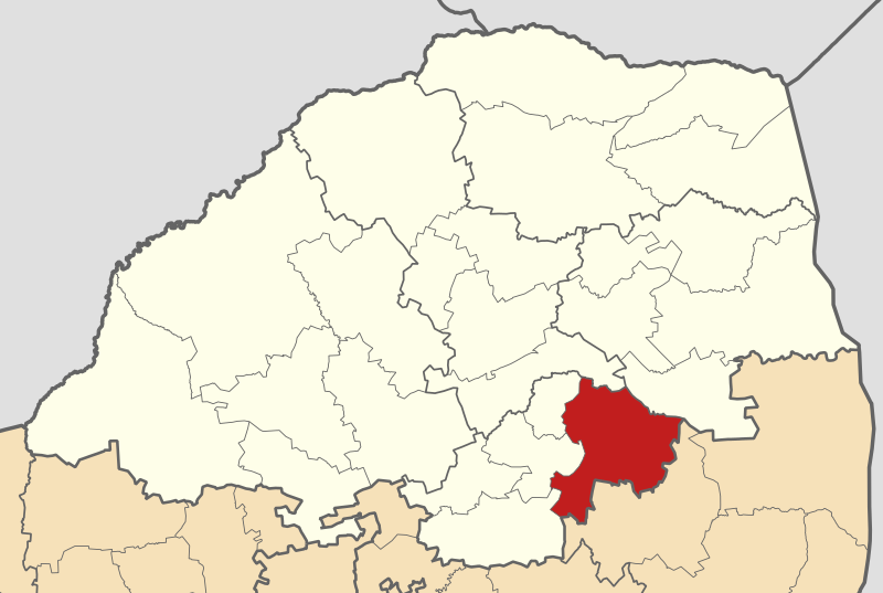
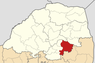
English: Map of municipal boundaries in Limpopo, as they will be after the municipal elections of 18 May 2011, with the Greater Tubatse Local Municipality highlighted in red. Based on File:Map of Limpopo with municipalities blank (2011).svg. |
| Letšatšikgwedi | |
| Mothopo | Own work |
| Mongwadi | Htonl |
.svg)
Laesense
I, the copyright holder of this work, hereby publish it under the following licenses:

|
Permission is granted to copy, distribute and/or modify this document under the terms of the GNU Free Documentation License, Version 1.2 or any later version published by the Free Software Foundation; with no Invariant Sections, no Front-Cover Texts, and no Back-Cover Texts. A copy of the license is included in the section entitled GNU Free Documentation License. |
This file is licensed under the Creative Commons Attribution-Share Alike 4.0 International, 3.0 Unported, 2.5 Generic, 2.0 Generic and 1.0 Generic license.
- You are free:
- to share – to copy, distribute and transmit the work
- to remix – to adapt the work
- Under the following conditions:
- attribution – You must give appropriate credit, provide a link to the license, and indicate if changes were made. You may do so in any reasonable manner, but not in any way that suggests the licensor endorses you or your use.
- share alike – If you remix, transform, or build upon the material, you must distribute your contributions under the same or compatible license as the original.
You may select the license of your choice.
Histori ya faele
Pinyeletša go letšatšikgwedi/nako go bona faela ka tsela yeo ebego e le ka gona nakong yeo.
| LetšatšiKgwedi/Nako | Nkgogorupo-Nala | Bogolo | Mošomiši | Comment | |
|---|---|---|---|---|---|
| bjale | 03:11, 14 Mopitlo 2011 | | 925 × 621 (267 KB) | Htonl | == Summary == {{Information |Description ={{en|1=Map of municipal boundaries in w:Limpopo, as they will be after the municipal elections of 18 May 2011, with the [[w:Greater Tubatse Local Municipality|] |
Tirišo ya Faele
Gago matlakala a hlomaganyago faeleng ye.
Global file usage
The following other wikis use this file:
- Usage on de.wikipedia.org
- Usage on en.wikipedia.org
- Usage on ha.wikipedia.org
- Usage on ig.wikipedia.org
- Usage on nl.wikipedia.org
- Usage on pl.wikipedia.org
- Usage on sw.wikipedia.org
- Usage on ts.wikipedia.org
- Usage on www.wikidata.org
- Usage on yo.wikipedia.org
- Usage on zu.wikipedia.org
.svg)