Seswantšho:South Africa Eastern Cape location map.svg

Size of this PNG preview of this SVG file: 800 × 556 pixels. Other resolutions: 320 × 222 pixels | 640 × 445 pixels | 1,024 × 712 pixels | 1,280 × 889 pixels | 2,560 × 1,779 pixels | 1,298 × 902 pixels.
''resolution'' ya gofella (SVG faele, nominally 1,298 × 902 pixels, bogolo ba faele: 282 KB)
Kakaretšo
| Description |
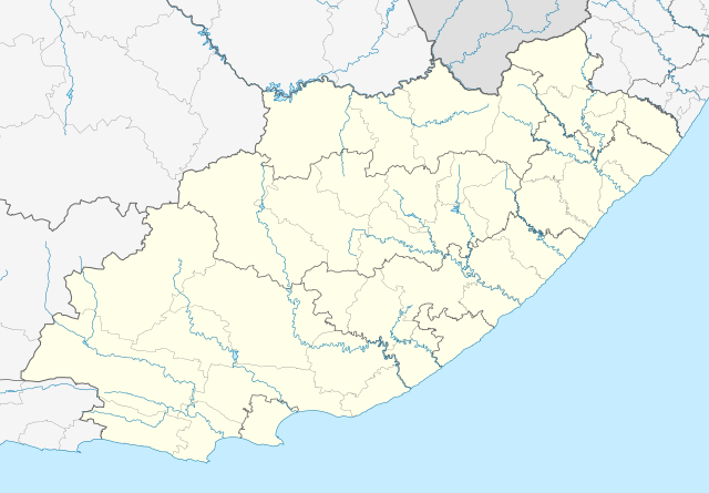
English: Location map of the Eastern Cape
Equirectangular projection, N/S stretching 117%. Geographic limits of the map:
|
| Letšatšikgwedi | |
| Mothopo |
|
| Mongwadi | Htonl |
| Permission (Reusing this file) |
I, the copyright holder of this work, hereby publish it under the following license: This file is licensed under the Creative Commons Attribution-Share Alike 3.0 Unported license.
|
| Other versions | File:South Africa Eastern Cape relief location map.svg, File:Blank map of the Eastern Cape (2011).svg |
| SVG genesis |
.svg)
Histori ya faele
Pinyeletša go letšatšikgwedi/nako go bona faela ka tsela yeo ebego e le ka gona nakong yeo.
| LetšatšiKgwedi/Nako | Nkgogorupo-Nala | Bogolo | Mošomiši | Comment | |
|---|---|---|---|---|---|
| bjale | 23:44, 4 Pherekgong 2013 | | 1,298 × 902 (282 KB) | Htonl | == {{int:filedesc}} == {{Information |Description ={{en|Location map of the Eastern Cape Equirectangular projection, N/S stretching 117%. Geographic limits of the map: * N: 29.75° S * S: 34.5° S * W: 22.5° E * E: 30.5° E}} |... |
Tirišo ya Faele
More than 100 pages use this file. The following list shows the first 100 pages that use this file only. A full list is available.
- Aberdeen, Eastern Cape
- Addo
- Adendorp
- Alexandria, Eastern Cape
- Alicedale
- Aliwal North
- Aston Bay
- Baccle's Farm
- Barkly East
- Bathurst
- Bhisho
- Boknesstrand
- Bolotwa
- Burgersdorp
- Bushman's River Mouth
- Cannon Rocks
- Cape St. Francis
- Clarkebury
- Clarkson
- Cofimvaba
- Coghlan
- Coldstream
- Cookhouse
- Cradock, Kapa Bohlabela
- Cuylerville
- Dordrecht, Kapa Bohlabela
- East London
- Elliot, Kapa Bohlabela
- Enon
- Ezibeleni
- Graaff-Reinet
- Grahamstown
- Hankey
- Herschel, Kapa Bohlabela
- Hofmeyr, Kapa Bohlabela
- Humansdorp
- Imvani
- Indwe
- Jamestown, Kapa Bohlabela
- Jansenville
- Jeffreys Bay
- Joubertina
- Kala
- Kareedouw
- Kasouga
- Kendrew
- Kenton-on-Sea
- Kirkwood, Eastern Cape
- Klipplaat
- Komani
- Kommadagga
- Krakeel River
- Kruisfontein
- Lady Frere
- Lady Grey, Kapa Bohlabela
- Lesseyton
- Loerie, Kapa Bohlabela
- Louterwater
- Maclear, Kapa Bohlabela
- Mbewuleni
- Middelburg, Kapa Bohlabela
- Middleton, Eastern Cape
- Misgund
- Molteno
- Mount Fletcher
- Mpofu
- Ncora
- Ngcobo
- Nieu-Bethesda
- Oviston
- Oyster Bay
- Paradise Beach
- Patensie
- Paterson
- Pearston
- Port Elizabeth
- Rhodes, Kapa Bohlabela
- Riebeek East
- Rietbron
- Rosmead
- Sada
- Salem, Kapa Bohlabela
- Somerset East
- Southwell, Eastern Cape
- St Francis Bay
- Sterkspruit
- Sterkstroom
- Steynsburg
- Steytlerville
- Stormsrivier
- Tarkastad
- Tentergate
- Thornham, Kou-Kamma
- Trappe's Valley
- Tsomo
- Tweeriviere
- Tylden
- Ugie, Kapa Bohlabela
- Uitenhage
- Venterstad
View more links to this file.
Global file usage
The following other wikis use this file:
- Usage on af.wikipedia.org
- Alice, Oos-Kaap
- Bhisho
- Oos-Londen
- Gqeberha
- Qunu
- Nieu-Bethesda
- Aliwal-Noord
- Dordrecht, Oos-Kaap
- Grahamstad
- Qonce
- Komani
- Cradock
- Bathurst, Oos-Kaap
- Port Alfred
- Graaff-Reinet
- Indwe
- Uitenhage
- Aberdeen, Oos-Kaap
- Adelaide (Suid-Afrika)
- Fort Beaufort
- Adendorp
- Addo-olifant- Nasionale Park
- Middelburg, Oos-Kaap
- Groot-Visrivier
- Hogsback
- Somerset-Oos
- Albanie
- Bethelsdorp
- Elliot
- Maclear
- Barkly-Oos
- Ugie
- Burgersdorp
- Rhodes, Oos-Kaap
- Seymour, Oos-Kaap
- Balfour, Oos-Kaap
- Lady Grey
- Jamestown, Oos-Kaap
- Sterkstroom
- Kamdeboo- Nasionale Park
- Nasionale Bergkwaggapark
- Mthatha
- Despatch
- Joubertina
- Boesmansriviermond
- Potsdam, Oos-Kaap
- Butterworth
- Mount Frere
- Stutterheim
- Bedford, Oos-Kaap
View more global usage of this file.