Seswantšho:South Africa KwaZulu-Natal location map.svg

Size of this PNG preview of this SVG file: 526 × 600 pixels. Other resolutions: 210 × 240 pixels | 421 × 480 pixels | 674 × 768 pixels | 898 × 1,024 pixels | 1,796 × 2,048 pixels | 1,000 × 1,140 pixels.
''resolution'' ya gofella (SVG faele, nominally 1,000 × 1,140 pixels, bogolo ba faele: 244 KB)
Kakaretšo
| Description |
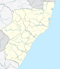
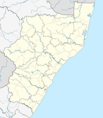
English: Location map of KwaZulu-Natal
Equirectangular projection, N/S stretching 114%. Geographic limits of the map:
|
| Letšatšikgwedi | |
| Mothopo |
|
| Mongwadi | Htonl |
| Permission (Reusing this file) |
I, the copyright holder of this work, hereby publish it under the following license: This file is licensed under the Creative Commons Attribution-Share Alike 3.0 Unported license.
|
| Other versions | File:South Africa KwaZulu-Natal relief location map.svg, File:Blank map of KwaZulu-Natal (2011).svg |
.svg)
Histori ya faele
Pinyeletša go letšatšikgwedi/nako go bona faela ka tsela yeo ebego e le ka gona nakong yeo.
| LetšatšiKgwedi/Nako | Nkgogorupo-Nala | Bogolo | Mošomiši | Comment | |
|---|---|---|---|---|---|
| bjale | 13:21, 5 Pherekgong 2013 | | 1,000 × 1,140 (244 KB) | Htonl | == {{int:filedesc}} == {{Information |Description ={{en|Location map of en:KwaZulu-Natal Equirectangular projection, N/S stretching 118%. Geographic limits of the map: * N: 26.75° S * S: 31.25° S * W: 28.75° E * E: 33.25° E}} |Source ... |
Tirišo ya Faele
More than 100 pages use this file. The following list shows the first 100 pages that use this file only. A full list is available.
- Albert Falls
- Amanzimtoti
- Amatikulu
- Anerley, KwaZulu Natala
- Babanango
- Ballito
- Barklieside
- Bazley, KwaZulu Natala
- Belgrade, KwaZulu Natala
- Bergville
- Bhucanana
- Bisi
- Blinkwater, KwaZulu Natala
- Bulwer, KwaZulu Natala
- Camperdown
- Ceza, KwaZulu Natala
- Clydesdale
- Creighton
- Dannhauser
- Donnybrook
- Dundee, KwaZulu Natala
- ESikhawini
- Eersteling
- Empangeni
- Eshowe
- Estcourt
- Felixton
- Franklin
- Gamalakhe
- Gingindlovu
- Glencoe
- Glückstadt, KwaZulu Natala
- Golela
- Greytown
- Hibberdene
- Himeville
- Hlabeni
- Hlobane
- Hluhluwe
- Ifafa Beach
- Ixopo
- Izingolweni
- Jozini
- Kelso, KwaZulu Natala
- Kokstad
- Kranskop
- KwaDukuza
- Kwambonambi
- Ladysmith
- Louwsburg
- Mahlabathini
- Marburg, KwaZulu Natala
- Margate
- Mbongolwane
- Melmoth, KwaZulu Natala
- Mkuze
- Mondlo
- Mtubatuba
- Mtunzini
- Mtwalume
- Munster, KwaZulu Natala
- Ncotshane
- Ncwadi
- Newcastle, KwaZulu Natala
- Nkandla, KwaZulu-Natal
- Nongoma
- Nquthu
- Ntabamhlophe
- Palm Beach, KwaZulu Natala
- Park Rynie
- Paulpietersburg
- Pennington, KwaZulu Natala
- Pevensey
- Pietermaritzburg
- Pivaanspoort
- Pomeroy
- Pongola
- Port Edward
- Port Shepstone
- Ramsgate
- Richards Bay
- Richmond, KwaZulu Natala
- Rietvlei
- Rondedraai
- Scottburgh
- Sezela
- Shelly Beach
- Southbroom
- St. Lucia, KwaZulu Natala
- Tamboekiesdraai
- Trafalgar, KwaZulu Natala
- Tugela Ferry
- Ulundi
- Umhlanga
- Umtentweni
- Umzimkhulu
- Umzinto
- Umzumbe
- Underberg
- Uvongo
View more links to this file.
Global file usage
The following other wikis use this file:
- Usage on af.wikipedia.org
- Durban
- Pietermaritzburg
- KwaMbonambi
- Amanzimtoti
- Margate, KwaZulu-Natal
- Weenen
- Mtunzini
- New Hanover, KwaZulu-Natal
- Ladysmith
- Kokstad
- Balgowan, KwaZulu-Natal
- Nottingham Road
- Nieu-Guelderland
- Vryheid, KwaZulu-Natal
- Utrecht, KwaZulu-Natal
- Hilton
- Ixopo
- Dannhauser
- Nkandla
- Newcastle, KwaZulu-Natal
- Ncandu-waterval
- Colenso
- Bergville
- Verulam
- Empangeni
- Greytown
- Hattingspruit
- Melmoth
- Mooirivier (KwaZulu-Natal)
- Scottburgh
- Port Shepstone
- KwaDukuza
- Louwsburg
- Tongaat
- Howick
- Glencoe, KwaZulu-Natal
- Richardsbaai
- Mahlabatini
- Estcourt
- Pinetown
- Sezela
- Nongoma
- Ulundi
- Eshowe
- Hluhluwe
- Charlestown, KwaZulu-Natal
- Harding
- Mkuze
- Paulpietersburg
- Kingsburgh
View more global usage of this file.