Seswantšho:Southern Ocean.png
Gago resolution ya go feta mo.
Southern_Ocean.png (330 × 330 pixel, bogolo ba faele: 10 KB, Mohuta wa MIME: image/png)

|
This locator map image could be re-created using vector graphics as an SVG file. This has several advantages; see Commons:Media for cleanup for more information. If an SVG form of this image is available, please upload it and afterwards replace this template with
{{vector version available|new image name}}.
It is recommended to name the SVG file “Southern Ocean.svg”—then the template Vector version available (or Vva) does not need the new image name parameter. |
Kakaretšo
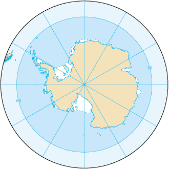
Southern_Ocean (from en:) Map from CIA Factbook 2003: Southern Ocean archive copy at the Wayback Machine (picture link is [1]).
![[1]](https://www.cia.gov/library/publications/the-world-factbook/maps/oo-map.gif)
English version: File:Southern Ocean - en.png Slovene version: File:Southern Ocean-sl.png
Laesense
This image is in the public domain because it contains materials that originally came from the United States Central Intelligence Agency's World Factbook.
|
 |
Histori ya faele
Pinyeletša go letšatšikgwedi/nako go bona faela ka tsela yeo ebego e le ka gona nakong yeo.
| LetšatšiKgwedi/Nako | Nkgogorupo-Nala | Bogolo | Mošomiši | Comment | |
|---|---|---|---|---|---|
| bjale | 22:16, 22 Phato 2009 | | 330 × 330 (10 KB) | Serg!o | language neutral map |
| 13:52, 3 Dibatsela 2004 |  | 330 × 330 (10 KB) | Maximaximax | Southern_Ocean (from en:) Map from [http://www.cia.gov/cia/publications/factbook/geos/oo.html CIA Factbook 2003: Southern Ocean] (picture link is [http://www.cia.gov/cia/publications/factbook/maps/oo-map.gif]). |
Tirišo ya Faele
Letlakala le ke latelago a hlomaganya go faele ye:
Global file usage
The following other wikis use this file:
- Usage on af.wikipedia.org
- Usage on an.wikipedia.org
- Usage on arc.wikipedia.org
- Usage on ar.wikipedia.org
- Usage on as.wikipedia.org
- Usage on azb.wikipedia.org
- Usage on az.wikipedia.org
- Usage on bat-smg.wikipedia.org
- Usage on ba.wikipedia.org
- Usage on be-tarask.wikipedia.org
- Usage on be.wikipedia.org
- Usage on bjn.wikipedia.org
- Usage on bs.wikipedia.org
- Usage on bxr.wikipedia.org
- Usage on ca.wikipedia.org
- Usage on cs.wikipedia.org
- Usage on cv.wikipedia.org
- Usage on da.wikipedia.org
- Usage on da.wiktionary.org
- Usage on el.wikipedia.org
- Usage on en.wikipedia.org
- Usage on en.wikibooks.org
- Usage on en.wikiversity.org
- Usage on en.wiktionary.org
View more global usage of this file.